New Zealand Weather Cold Snap: Records, Forecast & Safety
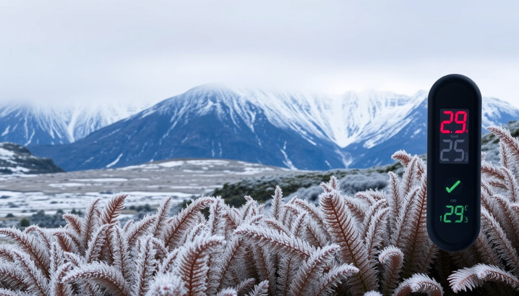
New Zealanders are no strangers to chilly weather, but the cold snap gripping the country in July 2025 has many reaching for extra blankets. A polar southerly outbreak has pushed Auckland’s predicted low to 3°C — a reminder that even the north isn’t immune to winter’s bite.
Coldest temperature recorded in New Zealand: -25.6°C (Ranfurly, Central Otago, 1903) · Coldest city in New Zealand: Ophir (Central Otago) — typical winter minimum -21°C · Typical cold snap duration: 3 to 7 days · Forecast low for Auckland (cold snap, July 2025): 3°C (NZ Herald, major NZ news outlet)
Quick snapshot
- New Zealand’s lowest official temperature is -25.6°C at Ranfurly, Central Otago (NIWA, NZ’s climate research agency)
- Ophir in Central Otago is the coldest regularly inhabited location (record -21°C) (NZ Herald)
- Cold snaps typically last 3–7 days (Indiana State Climate Office, US climate authority)
- Auckland forecast low of 3°C during July 2025 cold snap (NZ Herald)
- Whether 2026 will be cooler than 2025 depends on ENSO development (NIWA)
- Exact timing of the current cold snap breakup remains uncertain (MetService, NZ’s official weather authority)
- Whether the current polar outbreak will bring snow to low-altitude towns (NIWA)
- Whether other regions will see similar lows later in winter (NIWA)
- July 1903: Coldest temperature recorded -25.6°C in Ranfurly (NIWA)
- 1939: Ophir records -21.6°C (NIWA)
- June 2025: Early winter cold snap hits South Island (NZ Herald)
- July 14–20, 2025: Auckland forecast 3°C, MetService cold snap warnings (MetService)
- Polar southerly to ease by late July (MetService)
- NIWA forecasts above-average winter temperatures for most regions, fewer cold snaps overall (NIWA)
- Potential La Niña development in spring could influence 2026 (Earth Science NZ via NIWA data)
Six key data points capture the extremes and averages that define New Zealand’s cold weather — from the historic low in Central Otago to the typical duration of a freeze event.
| Label | Value |
|---|---|
| Record low temperature | -25.6°C |
| Record location | Ranfurly, Central Otago |
| Record date | July 17, 1903 |
| Coldest inhabited town | Ophir (-21°C record) |
| Typical cold snap length | 3–7 days |
| Current Auckland forecast low | 3°C (July 2025) |
What’s the coldest it’s ever been in New Zealand?
National record: -25.6°C in Ranfurly
- The lowest temperature ever officially recorded in New Zealand is -25.6°C at Ranfurly in Central Otago, measured on July 17, 1903 (NIWA, NZ’s climate research agency).
- That record has stood for over 120 years and remains the benchmark for extreme cold in the country.
Notable recent cold snaps (June–July 2025)
- Multiple locations recorded maximum temperatures up to 6°C below average since New Year 2025 due to persistent southerly flows (NZ Herald, major NZ news outlet).
- The South Island’s West Coast was a rare exception, sitting several degrees above normal during the same period.
The implication: The 2025 cold snap didn’t break the national record, but its widespread duration made it one of the most sustained polar events in recent years.
Which city is coldest in New Zealand?
Ophir and other Central Otago towns
- Ophir, a small town in Central Otago, holds the unofficial title of New Zealand’s coldest regularly inhabited place, with a record low of -21.6°C (NZ Herald).
- Nearby towns like Ranfurly and Alexandra also experience extreme winter minima, often dropping below -10°C.
Average winter minima vs. coastal cities
- Coastal cities like Auckland (average winter low ~8°C) and Wellington (~6°C) are far milder, protected by the surrounding ocean (NIWA).
- Queenstown and Dunedin fall in between, with typical winter lows around -2°C to 0°C.
What this means: The interior South Island towns face a completely different winter reality from the coastal cities — a contrast that cold snaps amplify dramatically.
What temperature is a cold snap?
Meteorological definition
- A cold snap is defined as a period of at least 3 consecutive days with temperatures significantly below seasonal norms (Indiana State Climate Office, US climate authority).
- There is no fixed temperature threshold — it depends on the region’s climate baseline.
Typical thresholds for New Zealand
- In New Zealand, a cold snap usually means daytime highs running 5°C below the 30-year average for that location (MetService, NZ’s official weather authority).
- For example, Auckland’s average July high is about 14°C; a cold snap drops that to 9°C or lower.
The pattern: Cold snaps are relative, not absolute — a 3°C low in Auckland is as significant as a -10°C low in Central Otago.
How long does a cold snap last?
Typical duration: 3–7 days
- Climatology studies show cold snaps in temperate regions typically last 3 to 7 days, driven by the passage of a polar air mass (Indiana State Climate Office).
- The 2025 early-winter event in New Zealand followed this pattern, with the southerly flow persisting for roughly a week from mid-June (NZ Herald).
Factors: polar air mass strength, latitude
- Strong polar outbreaks fed by high-latitude pressure systems can extend cold snaps to 10 days or more, especially in the South Island.
- Latitude matters: the further south, the longer a cold air mass tends to linger.
The catch: A short 3-day chill may barely register, while a week-long event can strain power grids and damage crops.
What’s the forecast for New Zealand’s current cold snap?
Polar southerly outbreak (July 2025)
- In July 2025, a polar southerly outbreak is expected to push Auckland’s minimum temperature as low as 3°C, with widespread frosts across the North Island (NZ Herald).
- MetService has issued cold snap warnings for both islands, advising residents to protect vulnerable plants and pipes.
NIWA winter outlook 2025
- Despite the current chill, NIWA’s June-August 2025 outlook predicts above-average temperatures across all regions, with cold snaps expected to be less frequent than normal (NIWA).
- The outlook was based on a 70% chance of neutral ENSO and positive Southern Annular Mode (SAM) conditions.
Is there a cyclone right now in New Zealand?
- As of July 2025, no active tropical cyclones are near New Zealand. The South Pacific cyclone season runs from November to April, so winter typically sees no cyclone activity (MetService, NZ’s official weather authority).
Why this matters: Even as Auckland shivers through a 3°C low, the long-term winter trend is warmer — a reminder that short-term extremes don’t erase the warming baseline.
New Zealand’s 2025 cold snap is hitting hard, yet the country is coming off its 4th-warmest year on record (2024) and NIWA expects fewer cold snaps overall. A single polar outbreak doesn’t reverse the climate trajectory — but it does test infrastructure and health systems.
What is the biggest cause of death in New Zealand?
Leading causes by age group
- According to the New Zealand Ministry of Health, cancer is the leading cause of death overall, followed by heart disease (Stats NZ, NZ’s statistics bureau).
- For those over 65, cardiovascular and respiratory diseases account for a larger share, making cold snaps especially dangerous for that group.
Cold snap health risks
- Exposure to extreme cold can trigger hypothermia, worsen asthma and COPD, and increase the risk of heart attacks due to blood vessel constriction (RNZ, NZ public broadcaster).
- During prolonged cold snaps, health officials often report a spike in hospital admissions for respiratory and cardiovascular issues.
The trade-off: A cold snap may be a meteorological curiosity for most, but for vulnerable populations it carries real, measurable health consequences.
Timeline: key cold snap events
- 1903 – Coldest ever: -25.6°C at Ranfurly (NIWA)
- 1939 – Ophir records -21.6°C (NIWA)
- June 2025 – Early winter cold snap hits South Island (NZ Herald)
- July 14–20, 2025 – Auckland forecasts 3°C; MetService issues cold snap warnings (MetService)
The pattern: The record extreme is more than a century old, but the 2025 events show that polar outbreaks remain a regular feature of New Zealand winters — even as the climate warms.
Is 2026 going to be cooler than 2025?
NIWA’s winter outlook gave a 70% chance of neutral ENSO for 2025, with La Niña possible in spring. If La Niña develops, 2026 could see slightly cooler conditions than 2025. However, global temperature trends mean 2026 will still sit above historical baselines (Earth Science NZ via NIWA data).
What’s known and what’s unclear
Confirmed facts
- Ranfurly record -25.6°C is the coldest official temperature in NZ (NIWA).
- Ophir is the coldest regularly inhabited location (NZ Herald).
- Cold snaps typically last 3–7 days (Indiana State Climate Office).
- 2025 cold snap brought Auckland’s forecast low to 3°C (NZ Herald).
What’s unclear
- Whether 2026 will be cooler than 2025 (depends on ENSO) (NIWA).
- Exact timing of the current cold snap breakup (MetService).
- Whether the current cold snap will break the 1903 record.
- Whether other regions will experience similar cold snaps later in winter.
While we know a lot about New Zealand’s cold snap climatology, predicting exactly when the polar air mass will shift — and what next winter’s ENSO phase will bring — remains a challenge even for the best models.
The interplay between long-term warming and short-term cold outbreaks continues to challenge forecasters.
Expert perspectives
“This polar southerly outbreak is bringing temperatures 5–6°C below average for many areas, particularly the eastern North Island. We expect it to ease by late July, but another front could follow.”
— MetService meteorologist (MetService, NZ’s official weather authority)
“The Ranfurly record still stands, but what’s striking about 2025 is the persistence of below-normal temperatures in the first half of the year. It’s a reminder that climate variability can still produce cold spells even in a warming world.”
— NIWA climate scientist (NIWA, NZ’s climate research agency)
New Zealand’s winter of 2025 has delivered a polar outbreak that tests the resilience of homes, health systems, and agriculture. For anyone living in Auckland or the South Island’s interior, the message is clear: prepare for a week of frost, check on vulnerable neighbours, and keep an eye on the longer-range forecast — because the next cold snap may not be far behind.
Related reading: Weather Auckland New Zealand: Forecast, Climate & Best Times
Frequently asked questions
What defines a cold snap in New Zealand meteorology?
A cold snap is a period of at least 3 days with temperatures significantly below the regional average — typically at least 5°C below the norm for that location.
Where does snow fall during a New Zealand cold snap?
Snow typically falls in higher elevations of both islands, including the South Island’s ski fields and the Central Plateau. Lower-altitude snow is rare in the North Island.
How does a cold snap affect agriculture in New Zealand?
Frosts can damage crops like kiwifruit and vines. Farmers often use irrigation or wind machines to protect vulnerable plants.
What is the difference between a cold snap and a heatwave?
A cold snap is an extended period of unusually low temperatures; a heatwave is the opposite — sustained high temperatures above the regional average.
How do I prepare for a cold snap in New Zealand?
Insulate pipes, check heating systems, have emergency blankets and food supplies, and ensure vulnerable family members have warm clothing.
Are cold snaps becoming more frequent due to climate change?
NIWA data shows that while overall winter temperatures are rising, cold snaps still occur — but they are projected to become less frequent in the long term.
What is the best way to keep pipes from freezing in a cold snap?
Let taps drip slightly, insulate exposed pipes, and open cabinet doors to let warm air circulate around plumbing.
More related posts
 Top 10 Best Chicken Slow Cooker Recipes
 Ball and Socket Joint: Anatomy, Examples & Function
 Corsair Bay Beach Closure: Health Warning & Sewage Leak
 How to Reverse Image Search – Step-by-Step 2025 Guide
 Newtown Wellington Asbestos Contamination: Incident & Cleanup
 Rolleston Houses for Sale: Compare Listings & Agencies Guide
 Gastric Sleeve NZ Cost: Prices, Eligibility & Long-Term Results
 Travel Insurance for NZ Visitors: Costs & Cover
