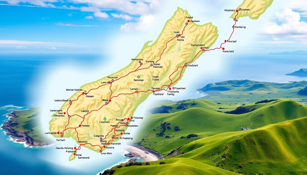
North Island Map NZ: Driving Times & Towns
Few things spark a road trip daydream quite like a map of New Zealand’s North Island, with its volcanic peaks, golden beaches, and twisty coastal roads. The full driving loop covers about 2,000 km — that’s around 14 to 21 days if you want to actually stop and explore, according to the NZ Pocket Guide (travel planning site). This guide pulls together official maps, driving times, and town rankings so you can plan your trip without the guesswork.
North Island land area: 113,729 km² ·
Driving loop distance: approx. 2,000 km ·
Suggested driving days: 14–21 days ·
Major towns & cities: 30+ ·
Population (North Island): ~3.9 million
Quick snapshot
- Official NZ touring map PDF available from Tourism New Zealand (national tourism office)
- Full North Island loop approx. 2,000 km (NZ Pocket Guide)
- Exact driving times vary by season, traffic, and vehicle type (Laura the Explorer (travel blog))
- “Most beautiful town” is subjective across sources (Laura the Explorer (travel blog))
- Peak season (Dec–Feb) means busier roads and booked accommodation; shoulder seasons (Mar–Apr, Oct–Nov) offer milder weather and fewer crowds (Journey Planner (official transport tool))
- New Zealand Transport Agency Journey Planner (official transport tool) provides real-time road warnings
- Download the free official touring map PDF and pair it with Google Maps for live navigation
- Plan a 14–21 day itinerary using the driving times in this guide (free official touring map PDF)
The pattern is clear: official sources agree on the 2,000 km loop, but exact travel times depend on your pace.
| Fact | Value |
|---|---|
| Total driving distance (loop) | ~2,000 km (NZ Pocket Guide) |
| Suggested driving days | 14 to 21 (NZ Pocket Guide) |
| Largest city | Auckland (pop. ~1.7M) (Tourism New Zealand) |
| Capital | Wellington (pop. ~215K) (Tourism New Zealand) |
| Most visited national park | Tongariro National Park (Tourism New Zealand) |
| Highest peak | Mount Ruapehu (2,797 m) (Tourism New Zealand) |
How long does it take to drive around North Island, New Zealand?
Typical driving route lengths
- Full loop including Cape Reinga, Auckland, Waitomo, Rotorua, Taupō and Wellington: roughly 2,000 km and about 16 hours of non-stop driving, per NZ Pocket Guide (route planning site)
- Auckland to Paihia: 3h 15m, 186 km (Laura the Explorer)
- Rotorua to Taupō: 1h 15m, 90 km (Laura the Explorer)
- Taupō to Wellington: roughly 4.5 hours via State Highway 1 (Tourism New Zealand)
Most travelers underestimate how much time stops add. Laura the Explorer warns that Google Maps times are “pretty accurate” between main centres, but campervans and winding roads can add 20–30% to journey times (Laura the Explorer).
Best multi-day itinerary options
- 14-day relaxed loop: Auckland → Coromandel → Rotorua → Taupō → Wellington → return via Napier and Bay of Plenty (NZ Pocket Guide)
- 21-day thorough trip: includes Far North (Cape Reinga) and East Cape, plus side trips to Tongariro Alpine Crossing (Tourism New Zealand)
- Minimum 7-day express: Auckland → Waitomo → Rotorua → Taupō → Wellington — about 1,200 km driven over 10 hours (Laura the Explorer)
The pattern: the more you rush, the more you miss. A 14-day trip gives you at least two nights in each major stop, while 7 days forces a daily packing ritual.
Which is nicer, north or South Island, New Zealand?
Scenic differences
- North Island: geothermal wonders (Rotorua, Taupō), long sandy beaches (Bay of Islands, Coromandel), rolling green hills (Tourism New Zealand)
- South Island: Southern Alps, glaciers (Franz Josef, Fox), fiords (Milford Sound), and turquoise lakes (Tourism New Zealand)
Climate and activities
- North Island is generally warmer (subtropical in the north); South Island has more alpine and polar climate zones (Tourism New Zealand)
- North Island: Maori culture experiences, hot springs, wine regions (Hawke’s Bay, Martinborough)
- South Island: skiing, tramping, bungee jumping (Queenstown), wildlife (kiwi, penguins)
Crowds and infrastructure
- North Island has more extensive roading and major cities (Auckland, Wellington) — better for rental cars and campervans (Tourism New Zealand)
- South Island has fewer highways and larger distances between towns; driving times are longer relative to distance
6 key differences, one pattern: the North Island is warmer, more built-up, and faster to drive; the South Island is wilder, more dramatic, and requires more travel time per kilometre.
| Aspect | North Island | South Island |
|---|---|---|
| Characteristic landscape | Geothermal, beaches, rolling farmland | Mountains, glaciers, fiords |
| Average summer temp | 20–25°C | 15–22°C |
| Major cities | Auckland, Wellington | Christchurch, Queenstown |
| Driving loop time (full) | 14–21 days | 21–30 days |
| Cultural highlights | Maori marae, hot springs, wine tours | Gold-mining history, fjord cruises |
| Best for | Beach lovers, first-time visitors, families | Adventure seekers, photographers, hikers |
The trade-off: travelers with only two weeks will cover more ground on the North Island. Those seeking raw nature should spend two weeks on the South Island and skip the North — but both offer world-class scenery, as Tourism New Zealand notes, making the choice dependent on your personal travel style.
What is the biggest town in the North Island?
List of largest cities
- Auckland – population ~1.7 million, largest city in New Zealand (Tourism New Zealand)
- Wellington – capital city, population ~215,000 (Tourism New Zealand)
- Hamilton – ~185,000, inland hub in Waikato
- Tauranga – ~160,000, port city in Bay of Plenty
- Napier-Hastings – ~135,000 combined, Art Deco region
Population data
| Town / City | Population (approx.) | Region |
|---|---|---|
| Auckland | 1,695,000 | Auckland |
| Wellington | 215,000 | Wellington |
| Hamilton | 185,000 | Waikato |
| Tauranga | 160,000 | Bay of Plenty |
| Napier-Hastings | 135,000 | Hawke’s Bay |
| Rotorua | 79,000 | Bay of Plenty |
| New Plymouth | 76,000 | Taranaki |
| Whangārei | 62,000 | Northland |
What this means: Auckland dominates as the urban anchor, but the North Island’s charm lies in the mid-sized towns that give each region its character — from Rotorua’s geothermal steam to Napier’s Art Deco streets.
What is the most beautiful town in NZ?
Top-rated beautiful towns on North Island
- Rotorua – geothermal landscapes, lakefront, Maori culture (Tourism New Zealand)
- Taupō – enormous lake, snow-capped volcanoes, trout fishing
- Bay of Islands towns (Paihia, Russell, Kerikeri) – sub-tropical beaches, historic sites
- Coromandel Peninsula (Whitianga, Thames) – golden beaches, hot water beach
- Napier – Art Deco architecture, waterfront promenade
Criteria for beauty
Beauty is subjective, as Tourism New Zealand notes. But common threads appear: natural surroundings (lake, sea, or mountains), well-preserved architecture, and accessible local culture. On the North Island, geothermal activity adds a unique visual drama that the South Island lacks.
First-time visitors often skip the North Island’s hidden gems for South Island glory. But towns like Taupō and Rotorua consistently rank among travelers’ most memorable stops — precisely because they combine scenery with interactive culture, not just views.
How do I find a north island map nz with cities and driving times?
Best sources for printable maps (PDF, Google Maps)
- Official Tourism New Zealand PDF – free download of the “New Zealand Touring Map” (code p23573_23) covers the North Island with major roads and distances (Tourism New Zealand)
- Google Maps – interactive driving directions, live traffic, and estimated travel times; Laura the Explorer says times are “pretty accurate” between main centres
- Guest New Zealand – a detailed North Island map highlighting Northland, Auckland, Coromandel, Bay of Plenty, Rotorua, Taupō, Hawke’s Bay and Wellington (Guest New Zealand (travel information site))
Official NZ tourism maps
- The New Zealand Touring Map PDF includes travel distances and is more detailed than generic road maps, according to First Light Travel (travel agency)
- Hard copies available at i-SITE visitor centres across the North Island (Tourism New Zealand)
Interactive online maps
- Google Maps allows you to click any two points for precise driving distance and time
- New Zealand Transport Agency Journey Planner – provides road closures, hazards, and EV charging locations (NZ Tourism Tours (route planning site))
- Maps.me and Organic Maps – free offline maps with downloadable regions for the North Island
The catch: the official PDF is great for planning, but you’ll want Google Maps or an offline app for real-time driving — cell reception can be patchy in the Coromandel and East Cape.
Confirmed facts vs. What’s unclear
Confirmed facts
- Driving loop distance is approx. 2,000 km from multiple sources (NZ Pocket Guide, Laura the Explorer)
- Auckland is the most populous city in the North Island (Tourism New Zealand)
- Tourism NZ publishes a free official touring map PDF (Tourism New Zealand)
- Guest New Zealand’s detailed map includes all major towns and regions (Guest New Zealand)
- NZ Pocket Guide states driving the full North Island route takes about 16 hours non-stop (NZ Pocket Guide)
What’s unclear
- Exact “most beautiful town” is subjective and varies by source — no single authority
- Driving times on specific roads can vary significantly by season and traffic (Laura the Explorer)
- Road conditions and construction can alter recommended route duration (NZ Tourism Tours)
“The New Zealand Touring Map is the essential planning tool for any North Island road trip — it shows all state highways and distances in one clear document.”
— Tourism New Zealand (official tourism office) via the touring map PDF
“Google Maps times are pretty accurate between main centres, but add extra time for campervans and windy roads. The drive from Auckland to Whitianga takes 2h 30m, but if you stop for photos it’ll be 3 hours easily.”
— Laura the Explorer (travel blog), North Island itinerary guide
For travelers planning a North Island road trip, the choice is clear: download the official Tourism NZ touring map, budget at least 14 days for the full loop, and always add a 20% buffer to Google’s driving estimates — because the stops are the point, not the destination.
For travelers comparing both islands, a detailed South Island map provides essential information on cities, roads, and parks across the South Island.
Frequently asked questions
What is the best time of year to drive the North Island?
Summer (December to February) offers warmest weather but peak crowds and accommodation prices. Shoulder seasons (March–April and October–November) deliver mild conditions, fewer tourists, and lower costs (Tourism New Zealand).
Do I need a 4WD to drive the North Island?
No. The vast majority of North Island roads are sealed state highways. A standard 2WD sedan is sufficient for all main routes. However, some gravel roads to remote beaches (e.g., Ninety Mile Beach) may require 4WD or a high-clearance vehicle (Tourism New Zealand).
Can I drive the North Island in one week?
Technically yes, but you’ll spend 4–5 hours driving each day and miss most attractions. A week is enough for a fast loop: Auckland → Waitomo → Rotorua → Taupō → Wellington. For a relaxed trip with stops, 14–21 days is recommended (NZ Pocket Guide).
Is the North Island map available for offline use?
Yes. Download the official Tourism NZ PDF to your phone or tablet. Additionally, apps like Google Maps (offline areas), Maps.me, and Organic Maps allow you to download the North Island region for turn-by-turn navigation without data (Tourism New Zealand).
What are the must-see stops on a North Island road trip?
Most itineraries include: Auckland (harbour, museums), Rotorua (geothermal parks, Maori village), Taupō (lake, Huka Falls), Tongariro National Park (alpine crossing), Wellington (Te Papa museum, cable car), Bay of Islands (beaches, dolphin cruises), and the Coromandel Peninsula (Tourism New Zealand).
How much does a North Island road trip cost?
Budget roughly NZD 150–250 per day per person including fuel, accommodation (mix of camping and motels), food, and activities. Petrol costs about NZD 2.50–3.00 per litre (2025 rates) (NZ Pocket Guide).
Do I need a separate map for South Island?
If you’re only visiting the North Island, the official NZ Touring Map covers both islands, but you’ll likely want the full South Island version for a separate trip. The PDF is one document with both islands (Tourism New Zealand).
More related posts
 New Zealand vs England Match Scorecard 2026 – Test Series
 Best Lemon Cake Recipe NZ: Moist Recipes from Top Kiwi Cooks
 DJI Mini 5 Pro: Price, Specs, Legality & Mini 4 Pro Comparison
 NZ Dollar to Philippine Peso: Rate & Cost of Living Guide 2025
 Bay of Plenty Times News: Tauranga Updates & Events
 House for Sale Dunedin: 2025 Listings, Prices & Buying Guide
 Auckland to Doha Flight Time Duration and Tips
 How Long Does Viagra Last? Duration & Key Facts
